How Directional Drilling Works in San Antonio Ground
The escarpment: one metro, two grounds
The Balcones Escarpment draws the line this whole trade prices by. North of it: Edwards and associated limestones — competent rock honeycombed with karst features, the same porosity that makes it a world-class aquifer making it a distinctive drilling environment. South of it: clays running toward the brush country, classic soft-ground Texas boring. Most metros have geology; San Antonio has a boundary, and every quote here starts by asking which side your alignment is on.
Karst deserves its own sentence: dissolution voids and fractures mean a bore can lose returns or find open space mid-shot. That's a known feature of the ground, handled by written procedure — grout-and-continue decisions, fluid-loss response, documentation — not a surprise to improvise around.
Drilling over the aquifer
Much of the metro's northern growth sits on the mapped recharge and contributing zones of the Edwards Aquifer, where state rules regulate activities that could introduce contamination. For HDD the practical translation: the drilling fluid program is a compliance document. Containment at entry and exit, spill kits staged, monitoring of returns, void-encounter procedures, and disposal handled clean. We build recharge-zone bore plans this way as the default — it's the local license to operate.
The sequence, Hill Country edition
The bones don't change: 811 locates plus private designating, potholes on crossing utilities, pilot bore, reaming to roughly one and a half times product, pullback, restoration. The local bends: rock tooling staged north of the escarpment, entry/exit benched to Hill Country grades, fluid volumes planned for limestone's appetite, and restoration on thin caliche-over-rock soils done with the right material because the native dirt you excavated may barely exist.
Who owns what you're crossing
City streets carry municipal ROW permits; county roads carry each county's public-works process; state corridors run through TxDOT's utility-installation system under the accommodation rules. The rivers add river-authority requirements on improved reaches and federal review where regulated. Rail crossings run on the railroad's clock. And over the aquifer, the state's Edwards rules ride along on everything. Our quotes name each authority on your alignment — every one of them is schedule.
Straight answers
What happens if the bore hits a void?
The bore plan already says: pause, assess fluid behavior, execute the written procedure — commonly grouting the interval and re-establishing the bore — and document it. Voids are a mapped feature of karst country; the difference between a specialist and a tourist here is having the procedure before the void, not after.
How deep do bores run under San Antonio streets?
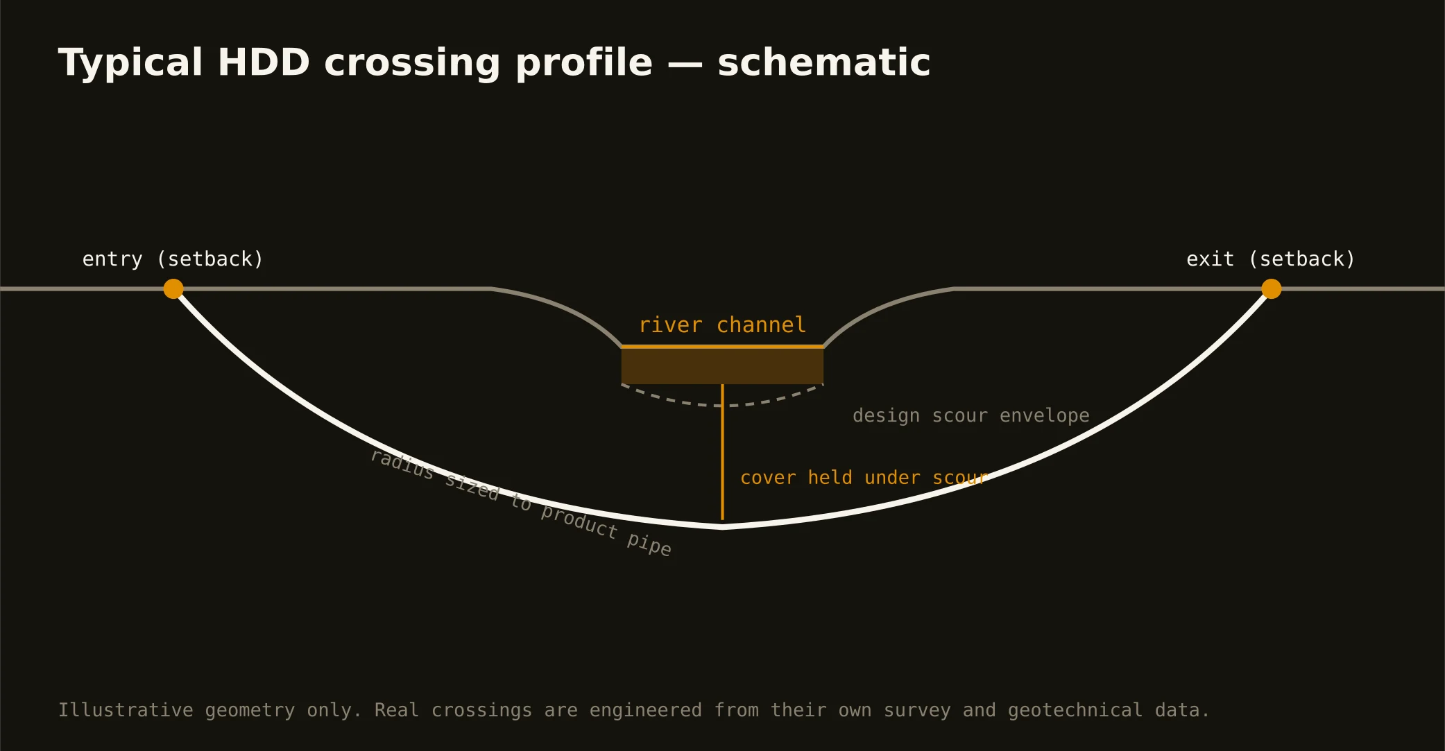
Cover follows the owning authority's standard and sits below everything potholed on the alignment; TxDOT corridors and engineered river crossings run deeper, set by the accommodation rules and scour design respectively. The bore plan states the number for your crossing.
Is clay-side drilling just easy mode?
Easier tooling, yes — but southern-metro clays bring shrink-swell behavior and wet-season fluid discipline of their own, and growth-corridor congestion under arterials doesn't care what the ground is made of. Different product, same scope rigor.
Ready to put a number on a real crossing? Send the scope — a person prices it.